

Malaysia Airlines Flight MH370 'Last Detected over Strait of Malacca'

The missing Malaysian Airlines flight MH370 was last seen above the Strait of Malacca according to the Malaysian military, over an hour after it disappeared from air traffic control screens.
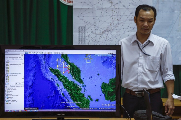
The MH370 flight took off from Kuala Lumpur toward the Chinese capital Beijing and disappeared while it was flying between Malaysia's east coast town of Kota Bharu and the southern part of Vietnam, at 35,000ft.
An unnamed military official told Reuters that the plane "changed course after Kota Bharu and took a lower altitude. It made into the Malacca Strait".
Another official, Malaysia air force chief Rodzali Daud, told a local newspaper that the plane was detected for the last time by military radar at 2:40am on Saturday near the small island of Pulau Perak.
It was flying at a height of about 29,500ft.
The Malacca Strait is a narrow, 805km stretch of water between Malaysia and the Indonesian island of Sumatra.
The report has been checked by investigators, according to Reuters.
If confirmed, the reports mean that the plane flew one hour and 10 minutes after it was last detected by air traffic control screens over Igari, between Malaysia and Vietnam.
Malaysia authorities have widened the massive search operation for the plane to the Malacca Strait.
© Copyright IBTimes 2024. All rights reserved.
-

California Bill May Charge Employers $100 If They Call Or Text You Outside Of Work Hours
-

'You've Been Lied To About Buying Property': Multimillionaire On Why He Rents And Refuses To Buy Real Estate
-

Trump Says He Can End Russia-Ukraine War In 24 Hours By Giving Russia More Ukrainian Land
-

Businessmen Pay $18K To Join This Gruelling 3-day Bootcamp To Become Alphas
-

France Enshrines Abortion As Constitutional Right In World First


